| Location |
| City: | | Bossier City, Louisiana, United States |
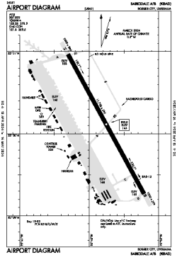
| Name: | Barksdale AFB |
| ICAO / IATA: | KBAD / BAD |
| FAA: | BAD |
Details |
| Type: | Airport (Airfield) |
| Use: | Military |
| Latitude: | 32°30'07"N (32.501933) |
| Longitude: | 93°39'45"W (-93.662627) |
| Datum: | WGS 1984 |
| Elevation: | 165 ft (50 m) |
| Runways: | 1 |
| Longest: | 11758 × 299 ft (3584 × 91 m) |
Time |
| Timezone: | UTC+28:08 (DST+31:08) |
| Local Time: | |
Weather |
| METAR: | KBAD | 041356Z AUTO 18008KT 10SM OVC009 17/17 A2990 RMK AO2 SLP127 T01730173
|
| TAF: | KBAD | 041006Z 0410/0516 18008KT 9999 OVC007 QNH2986INS TEMPO 0410/0414 4800 BR OVC004 BECMG 0417/0418 21012KT 9999 OVC012 QNH2985INS BECMG 0421/0422 21010KT 9999 OVC025 QNH2989INS TX25/0422Z TN16/0411Z
|
Related Locations |
| Nearby: | |
| Farthest: | CCK: 10885 mi / 17517 km
West Island (Pulau Panjang) [Cocos (Keeling) Islands], CC |
Find: |
|
Other Information |
Maps:
|
Links:
|
Sources:
|
|