| Location |
| City: | | Westfield/Springfield, Massachusetts, United States |
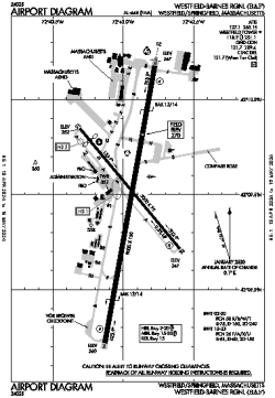
| Name: | Westfield-Barnes Regional |
| ICAO / IATA: | KBAF / BAF |
| FAA: | BAF |
Details |
| Type: | Airport (Part 139 Class IV) |
| Use: | Public/Civil |
| Latitude: | 42°09'29"N (42.157944) |
| Longitude: | 72°42'57"W (-72.715860) |
| Datum: | WGS 1984 |
| Elevation: | 270 ft (82 m) |
| Runways: | 2 |
| Longest: | 9000 × 150 ft (2743 × 45.5 m) |
Time |
| Timezone: | UTC+29:08 (DST+32:08) |
| Local Time: | |
Weather |
| METAR: | KBAF | 041353Z 00000KT 3SM BR CLR 00/M02 A3007 RMK AO2 SLP189 T00001017
|
| TAF: | KBAF | 041140Z 0412/0512 00000KT 2SM BR FEW250
FM041300 00000KT P6SM FEW250
FM041500 19005KT P6SM FEW250
FM050900 18004KT P6SM BKN080
|
Related Locations |
| Nearby: | |
| Farthest: | YAUG: 11746 mi / 18904 km
Augusta [Augusta Airport], WA, AU |
Find: |
|
Other Information |
Maps:
|
Links:
|
Sources:
|
|