| Location |
| City: | | Bloomington, Indiana, United States |
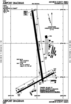
| Name: | Monroe County Airport |
| ICAO / IATA: | KBMG / BMG |
| FAA: | BMG |
Details |
| Type: | Airport (Part 139 Class IV) |
| Use: | Public/Civil |
| Latitude: | 39°08'46"N (39.146021) |
| Longitude: | 86°37'00"W (-86.616679) |
| Datum: | WGS 1984 |
| Elevation: | 845 ft (258 m) |
| Runways: | 2 |
| Longest: | 6500 × 150 ft (1981 × 45.5 m) |
Time |
| Timezone: | UTC+29:08 (DST+32:08) |
| Local Time: | |
Weather |
| METAR: | KBMG | 041353Z 15008KT 10SM BKN032 BKN100 09/08 A2986 RMK AO2 SLP112 T00890078
|
| TAF: | KBMG | 041123Z 0412/0512 18008KT P6SM BKN110
FM041500 18009KT P6SM VCSH OVC025
FM041800 20010KT 4SM -RA OVC008
FM042300 21008KT P6SM VCSH OVC003
FM050300 27006KT P6SM OVC003
FM050800 35006KT P6SM BKN008 AMD LTD TO CLD VIS AND WIND TIL 041400
|
Related Locations |
| Nearby: | |
| Farthest: | YAUG: 11192 mi / 18012 km
Augusta [Augusta Airport], WA, AU |
Find: |
|
Other Information |
Maps:
|
Links:
|
Sources:
|
|