| Location |
| City: | | Battle Creek, Michigan, United States |
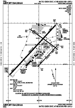
| Name: | Battle Creek Exec at Kellogg Field |
| ICAO / IATA: | KBTL / BTL |
| FAA: | BTL |
Details |
| Type: | Airport (Airfield) |
| Use: | Public/Civil |
| Latitude: | 42°18'23"N (42.306473) |
| Longitude: | 85°15'00"W (-85.250088) |
| Datum: | WGS 1984 |
| Elevation: | 951 ft (290 m) |
| Runways: | 3 |
| Longest: | 10004 × 150 ft (3049 × 45.5 m) |
Time |
| Timezone: | UTC+29:08 (DST+32:08) |
| Local Time: | |
Weather |
| METAR: | KBTL | 041400Z 19012KT 9SM -RA FEW046 SCT060 BKN075 08/06 A2978 RMK AO2 RAB1355 P0000 T00830061
|
| TAF: | KBTL | 041136Z 0412/0512 18008KT P6SM OVC035 WS020/23035KT
FM041500 19010KT 5SM -SHRA BR OVC025 WS020/22045KT
FM042000 21010KT 1 1/2SM -SHRA BR OVC007
FM050000 25008KT 2SM -DZ BR OVC007
FM050800 31010G18KT P6SM BKN007
|
Related Locations |
| Nearby: | |
| Farthest: | YAUG: 11206 mi / 18035 km
Augusta [Augusta Airport], WA, AU |
Find: |
|
Other Information |
Maps:
|
Links:
|
Sources:
|
|