| Location |
| City: | | Buffalo, New York, United States |
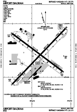
| Name: | Buffalo Niagara International Airport |
| ICAO / IATA: | KBUF / BUF |
| FAA: | BUF |
Details |
| Type: | Airport (Part 139 Class I) |
| Use: | Public/Civil |
| Latitude: | 42°56'26"N (42.940427) |
| Longitude: | 78°43'50"W (-78.730569) |
| Datum: | WGS 1984 |
| Elevation: | 726 ft (221 m) |
| Runways: | 2 |
| Longest: | 8829 × 150 ft (2691 × 45.5 m) |
Time |
| Timezone: | UTC+29:08 (DST+32:08) |
| Local Time: | |
Weather |
| METAR: | KBUF | 041354Z 20007KT 10SM FEW046 SCT075 SCT220 BKN270 07/03 A2995 RMK AO2 SLP146 T00720028
|
| TAF: | KBUF | 041131Z 0412/0512 22010KT P6SM OVC040 WS020/24040KT
FM041400 21010KT P6SM OVC040
FM041700 18007KT P6SM SCT100
FM050000 19014KT P6SM OVC070 WS020/21045KT
FM050200 19017G27KT 6SM -SHRA OVC015 WS020/21050KT
FM050600 22016G25KT 6SM -RA OVC007 WS020/23045KT
FM051000 25015G27KT P6SM BKN012
|
Related Locations |
| Nearby: | |
| Farthest: | YAUG: 11482 mi / 18478 km
Augusta [Augusta Airport], WA, AU |
Find: |
|
Other Information |
Maps:
|
Delays:
|
Links:
|
Sources:
|
|