| Location |
| City: | | Kerkyra, Corfu, Ionía Nísia (Ionian Islands), Greece |
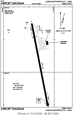
| Name: | Ioannis Kapodistrias International Airport |
| ICAO / IATA: | LGKR / CFU |
Details |
| Type: | Airport (Aerodrome, Airfield) |
| Use: | Public/Civil |
| Latitude: | 39°36'07"N (39.601944) |
| Longitude: | 19°54'42"E (19.911667) |
| Datum: | WGS 1984 |
| Elevation: | 6 ft (2 m) |
| Runways: | 1 |
| Longest: | 7792 × 148 ft (2375 × 45 m) |
Time |
| Timezone: | UTC+2 (DST+5) |
| Local Time: | |
Weather |
| METAR: | LGKR | 041350Z 36005KT CAVOK 20/06 Q1011 NOSIG
|
| TAF: | LGKR | 041100Z 0412/0512 VRB05KT 9999 SCT018 SCT080 BECMG 0418/0420 07015KT TEMPO 0500/0512 SCT018 BKN080
|
Related Locations |
| Nearby: | |
| Farthest: | CHT: 11547 mi / 18583 km
Waitangi [Tuuta], CIT, NZ |
Find: |
|
Other Information |
Maps:
|
Sources:
|
|