| Location |
| City: | | Cape Town, Western Cape, South Africa |
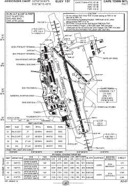
| Name: | Cape Town International (D.F. Malan) |
| ICAO / IATA: | FACT / CPT |
Details |
| Type: | Airport (Aerodrome, Airfield) |
| Use: | Public/Civil |
| Latitude: | 33°58'17"S (-33.971368) |
| Longitude: | 18°36'15"E (18.604292) |
| Elevation: | 151 ft (46 m) |
| Runways: | 2 |
| Longest: | 10502 × 200 ft (3201 × 61 m) |
Time |
| Timezone: | UTC+2 (DST+4) |
| Local Time: | |
Weather |
| METAR: | FACT | 041400Z 19019KT CAVOK 24/16 Q1017 NOSIG
|
| TAF: | FACT | 032200Z 0400/0506 20010KT 9999 BKN030 TX27/0412Z TN16/0404Z
FM040300 17010KT 9999 SCT030
FM040900 17018KT CAVOK
FM050300 17010KT CAVOK
|
Related Locations |
| Nearby: | |
| Farthest: | PHHF: 11676 mi / 18791 km
Tern Island [French Frigate Shoals Airport], HI, US |
Find: |
|
Other Information |
Maps:
|
Links:
|
Sources:
|
|