| Location |
| City: | | Shearwater, Nova Scotia, Canada |
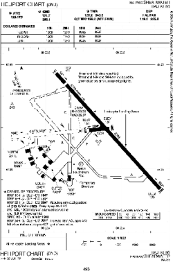
| Name: | CFB Shearwater (Halifax/Shearwater Heliport) |
| ICAO: | CYAW |
Details |
| Type: | Heliport |
| Use: | Military |
| Latitude: | 44°38'14"N (44.637222) |
| Longitude: | 63°30'08"W (-63.502221) |
| Elevation: | 144 ft (44 m) |
| Helipads: | 5 |
| Largest: | 3500 ft (1067 m) |
Time |
| Timezone: | UTC+30:08 (DST+33:08) |
| Local Time: | |
Weather |
| METAR: | CYAW | 041400Z 18017KT 12SM BKN010 OVC025 M01/M02 A3010 RMK SF7SC1 DA-1926FT SLP195
|
| TAF: | CYAW | 041109Z 0412/0424 19010KT P6SM SCT025 OVC040 TEMPO 0412/0413 6SM -SN SCT015 BKN025
FM041300 21012G22KT P6SM -SN SCT015 OVC025 TEMPO 0413/0415 21015G25KT 3SM -SNPL SCT008 OVC015 PROB30 0413/0415 3SM -FZRA BR
FM041500 21015G25KT 3SM -RAPL BR BKN008 OVC015 TEMPO 0415/0417 6SM -RA BR SCT008 OVC015
FM041700 22015G25KT 3SM -DZ BR BKN006 OVC012 TEMPO 0417/0419 6SM -RA BR SCT006 OVC012
FM041900 24008KT 3SM -DZ BR BKN006 BECMG 0420/0422 1/2SM -DZ FG VV002 RMK NXT FCST BY 041800Z
|
Related Locations |
| Nearby: | |
| Farthest: | YDEK: 11760 mi / 18925 km
Denmark, WA, AU |
Find: |
|
Other Information |
Maps:
|
Sources:
|
|