| Location |
| City: | | Medicine Hat, Alberta, Canada |
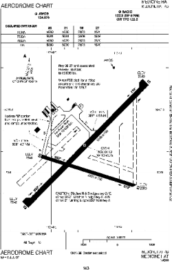
| Name: | Medicine Hat Airport |
| ICAO / IATA: | CYXH / YXH |
Details |
| Type: | Airport (Airfield) |
| Use: | Public/Civil |
| Latitude: | 50°01'08"N (50.018889) |
| Longitude: | 110°43'14"W (-110.720555) |
| Elevation: | 2351 ft (717 m) |
| Runways: | 2 |
| Longest: | 5000 ft (1524 m) |
Time |
| Timezone: | UTC+27:08 (DST+30:08) |
| Local Time: | |
Weather |
| METAR: | CYXH | 041400Z 06003KT 10SM -SN FEW016 OVC090 M24/M29 A3015 RMK SC1AC7 SLP285
|
| TAF: | CYXH | 041138Z 0412/0424 36005KT P6SM -SN SCT020 OVC040 TEMPO 0412/0415 2SM -SN OVC020
FM041500 05005KT P6SM -SN OVC060 TEMPO 0415/0419 5SM -SN
FM041900 02005KT 5SM -SN OVC040 TEMPO 0419/0424 2SM -SN VV020 PROB40 0419/0424 1SM -SHSN VV008 RMK FCST BASED ON AUTO OBS. NXT FCST BY 041800Z
|
Related Locations |
| Nearby: | |
| Farthest: | FAME: 10989 mi / 17685 km
Marion Island, Prince Edward Islands, WC, ZA |
Find: |
|
Other Information |
Maps:
|
Sources:
|
|