| Location |
| City: | | Swift Current, Saskatchewan, Canada |
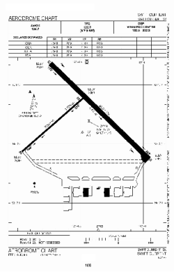
| Name: | Swift Current Airport |
| ICAO / IATA: | CYYN / YYN |
Details |
| Type: | Airport (Airfield) |
| Use: | Public/Civil |
| Latitude: | 50°17'33"N (50.292500) |
| Longitude: | 107°41'27"W (-107.690832) |
| Elevation: | 2681 ft (817 m) |
| Runways: | 2 |
| Longest: | 4250 ft (1295 m) |
Time |
| Timezone: | UTC+28:08 (DST+30:08) |
| Local Time: | |
Weather |
| METAR: | CYYN | 041400Z AUTO 02003KT 9SM BKN190 BKN210 M27/M30 A3008 RMK SLP279
|
| TAF: | CYYN | 041143Z 0412/0424 36008KT P6SM SCT030 OVC080 TEMPO 0412/0415 4SM -SN BKN020 OVC060
FM041500 06008KT 6SM -SN SCT020 OVC040 TEMPO 0415/0420 21/2SM -SN OVC015
FM042000 13008KT 4SM -SN SCT012 OVC025 TEMPO 0420/0424 11/2SM -SN OVC008 RMK FCST BASED ON AUTO OBS. NXT FCST BY 041800Z
|
Related Locations |
| Nearby: | |
| Farthest: | FAME: 10856 mi / 17471 km
Marion Island, Prince Edward Islands, WC, ZA |
Find: |
|
Other Information |
Maps:
|
Sources:
|
|