| Location |
| City: | | Happy Valley-Goose Bay, Newfoundland and Labrador, Canada |
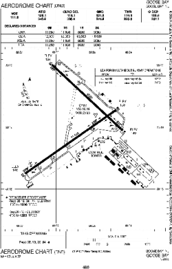
| Name: | CFB Goose Bay (Goosy Bay Airport) |
| ICAO / IATA: | CYYR / YYR |
Details |
| Type: | Airport (Airfield) |
| Use: | Public/Civil, Military |
| Latitude: | 53°19'09"N (53.319167) |
| Longitude: | 60°25'33"W (-60.425832) |
| Elevation: | 160 ft (49 m) |
| Runways: | 2 |
| Longest: | 11051 ft (3368 m) |
Time |
| Timezone: | UTC+30:38 (DST+33:38) |
| Local Time: | |
Weather |
| METAR: | CYYR | 041410Z 27005KT 1 1/2SM -SN OVC023 M14/M18 A2991 RMK SN5SC3 SLP133
|
| TAF: | CYYR | 041130Z 0412/0512 24015KT P6SM -SN SCT020 OVC030 TEMPO 0412/0420 4SM -SN OVC020
FM042000 26015KT P6SM SCT030 RMK NXT FCST BY 041800Z
|
Related Locations |
| Nearby: | |
| Farthest: | YCSK: 11484 mi / 18481 km
Casey Station [Casey Station Skiway], Wilkes Land, AQ |
Find: |
|
Other Information |
Maps:
|
Links:
|
Sources:
|
|