| Location |
| City: | | Dickinson, North Dakota, United States |
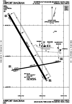
| Name: | Dickinson/Theodore Roosevelt Regional |
| ICAO / IATA: | KDIK / DIK |
| FAA: | DIK |
Details |
| Type: | Airport (Part 139 Class I) |
| Use: | Public/Civil |
| Latitude: | 46°48'02"N (46.800474) |
| Longitude: | 102°48'16"W (-102.804434) |
| Datum: | WGS 1984 |
| Elevation: | 2592 ft (790 m) |
| Runways: | 2 |
| Longest: | 7301 × 150 ft (2225 × 45.5 m) |
Time |
| Timezone: | UTC+28:08 (DST+31:08) |
| Local Time: | |
Weather |
| METAR: | KDIK | 041356Z AUTO 32013KT 8SM -SN CLR M23/M28 A3002 RMK AO2 SLP245 P0000 T12331278
|
| TAF: | KDIK | 041124Z 0412/0512 31012KT P6SM SCT050 BKN100
FM042100 05006KT P6SM SCT040
FM050000 06006KT P6SM VCSH OVC035
FM050300 08006KT P6SM VCSH BKN015
FM050600 10007KT P6SM OVC015
|
Related Locations |
| Nearby: | |
| Farthest: | YCSK: 10614 mi / 17082 km
Casey Station [Casey Station Skiway], Wilkes Land, AQ |
Find: |
|
Other Information |
Maps:
|
Links:
|
Sources:
|
|