| Location |
| City: | | Del Rio, Texas, United States |
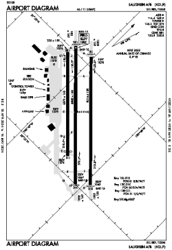
| Name: | Laughlin AFB |
| ICAO / IATA: | KDLF / DLF |
| FAA: | DLF |
Details |
| Type: | Airport (Airfield) |
| Use: | Military |
| Latitude: | 29°21'34"N (29.359399) |
| Longitude: | 100°46'41"W (-100.777922) |
| Datum: | WGS 1984 |
| Elevation: | 1081 ft (329 m) |
| Runways: | 3 |
| Longest: | 8852 × 150 ft (2698 × 45.5 m) |
Time |
| Timezone: | UTC+28:08 (DST+31:08) |
| Local Time: | |
Weather |
| METAR: | KDLF | 041356Z 13003KT 1/8SM R13/1000V1200FT FG VV001 16/16 A2989 RMK AO2A CIG 000 RWY31 SLP117 T01590159
|
| TAF: | KDLF | 041405Z 0414/0516 11006KT 0400 FG VV001 QNH2984INS TEMPO 0413/0415 3200 BR OVC005 BECMG 0415/0416 12006KT 8000 BR BKN010 BKN080 QNH2986INS BECMG 0417/0418 13004KT 9999 NSW SCT030 BKN090 QNH2988INS BECMG 0506/0507 16007KT 9999 OVC007 QNH2987INS TX24/0420Z TN14/0510Z
|
Related Locations |
| Nearby: | |
| Farthest: | RRG: 11246 mi / 18099 km
Plaine Corail [Sir Gaëtan Duval Airport (Plaine Corail Airport)], Rodrigues Island, MU |
Find: |
|
Other Information |
Maps:
|
Links:
|
Sources:
|
|