| Location |
| City: | | Chicago/West Chicago, Illinois, United States |
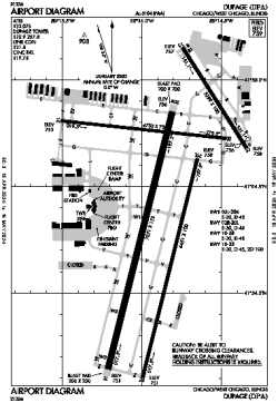
| Name: | Dupage Airport |
| ICAO / IATA: | KDPA / DPA |
| FAA: | DPA |
Details |
| Type: | Airport (Airfield) |
| Use: | Public/Civil |
| Latitude: | 41°54'25"N (41.907053) |
| Longitude: | 88°14'53"W (-88.247994) |
| Datum: | WGS 1984 |
| Elevation: | 758 ft (231 m) |
| Runways: | 4 |
| Longest: | 7571 × 150 ft (2308 × 45.5 m) |
Time |
| Timezone: | UTC+28:08 (DST+31:08) |
| Local Time: | |
Weather |
| METAR: | KDPA | 041415Z 18008KT 3SM -RA BR SCT008 BKN030 OVC050 06/04 A2967 RMK AO2 P0000 T00560044
|
| TAF: | KDPA | 041130Z 0412/0512 19012KT 6SM BR SCT015 BKN040 WS015/22040KT TEMPO 0413/0415 2SM -SHRA BR BKN015
FM041500 20013G20KT 3SM -SHRA BR SCT005 OVC010 WS020/23040KT TEMPO 0415/0419 1SM -SHRA BR OVC005
FM042000 27013G20KT P6SM SCT008 BKN010 OVC040
FM050100 30013G20KT P6SM SCT025
FM050800 32009KT P6SM SCT250
|
Related Locations |
| Nearby: | |
| Farthest: | YAUG: 11068 mi / 17812 km
Augusta [Augusta Airport], WA, AU |
Find: |
|
Other Information |
Maps:
|
Links:
|
Sources:
|
|