| Location |
| City: | | Darwin, Northern Territory, Australia |
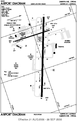
| Name: | Darwin International Airport |
| ICAO / IATA: | YPDN / DRW |
Details |
| Type: | Airport (Aerodrome, Airfield) |
| Use: | Public/Civil |
| Latitude: | 12°24'53"S (-12.414721) |
| Longitude: | 130°52'36"E (130.876667) |
| Datum: | WGS 1984 |
| Elevation: | 103 ft (31 m) |
| Runways: | 2 |
| Longest: | 11004 × 197 ft (3354 × 60 m) |
Time |
| Timezone: | UTC+9:30 (DST+11:30) |
| Local Time: | |
Weather |
| METAR: | YPDN | 041400Z 27012KT 9999 FEW018 SCT035 BKN370 28/25 Q1007
|
| TAF: | YPDN | 040531Z 0406/0512 27014KT 9999 SCT020
FM041000 28014KT 9999 SCT020
FM050100 27016G26KT 9999 SCT030
FM050900 27012KT 9999 SCT030 INTER 0406/0409 VRB15G25KT 2000 SHRA SCT010 INTER 0416/0502 VRB15G25KT 2000 SHRA SCT010 PROB30 TEMPO 0406/0408 VRB20G40KT 1000 TSRA BKN010 SCT020CB PROB30 TEMPO 0416/0422 VRB20G40KT 1000 TSRA BKN010 SCT020CB
|
Related Locations |
| Nearby: | |
| Farthest: | SOOY: 11884 mi / 19126 km
Sinnamary, GF |
Find: |
|
Other Information |
Maps:
|
Links:
|
Sources:
|
|