| Location |
| City: | | Eau Claire, Wisconsin, United States |
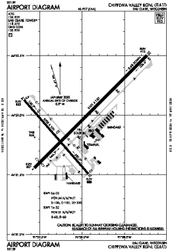
| Name: | Chippewa Valley Regional |
| ICAO / IATA: | KEAU / EAU |
| FAA: | EAU |
Details |
| Type: | Airport (Part 139 Class I) |
| Use: | Public/Civil |
| Latitude: | 44°51'57"N (44.865806) |
| Longitude: | 91°29'03"W (-91.484249) |
| Datum: | WGS 1984 |
| Elevation: | 913 ft (278 m) |
| Runways: | 2 |
| Longest: | 8101 × 150 ft (2469 × 45.5 m) |
Time |
| Timezone: | UTC+28:08 (DST+31:08) |
| Local Time: | |
Weather |
| METAR: | KEAU | 041356Z 29006KT 5SM BR OVC002 01/01 A2956 RMK AO2 RAB06E41UPB41E45 SLP019 P0000 T00110011
|
| TAF: | KEAU | 041139Z 0412/0512 32006KT 1 1/2SM -RA BR OVC003
FM041400 30010KT 3SM BR OVC004
FM041700 29012G18KT P6SM OVC008
FM042200 30010KT P6SM OVC012
|
Related Locations |
| Nearby: | |
| Farthest: | YAUG: 10853 mi / 17466 km
Augusta [Augusta Airport], WA, AU |
Find: |
|
Other Information |
Maps:
|
Links:
|
Sources:
|
|