| Location |
| City: | | Anchorage, Alaska, United States |
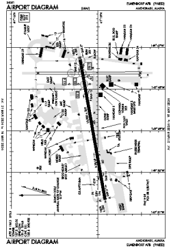
| Name: | Elmendorf AFB |
| ICAO / IATA: | PAED / EDF |
| FAA: | EDF |
Details |
| Type: | Airport (Airfield) |
| Use: | Military |
| Latitude: | 61°15'05"N (61.251353) |
| Longitude: | 149°48'23"W (-149.806525) |
| Datum: | WGS 1984 |
| Elevation: | 213 ft (65 m) |
| Runways: | 2 |
| Longest: | 10000 × 200 ft (3048 × 61 m) |
Time |
| Timezone: | UTC+25:08 (DST+28:08) |
| Local Time: | |
Weather |
| METAR: | PAED | 041356Z 08005KT 4SM BR SCT005 SCT011 OVC031 M05/M05 A3003 RMK AO2A SLP168 P0000 T10551055
|
| TAF: | PAED | 040300Z 0403/0509 04006KT 4800 -SN BR SCT007 OVC030 620306 520105 QNH3002INS TEMPO 0403/0406 BKN007 620079 BECMG 0411/0412 VRB06KT 4800 -SHRASN BR SCT007 OVC025 610408 QNH2999INS BECMG 0416/0417 VRB06KT 8000 BR BKN025 620256 QNH2997INS TXM05/0500Z TNM09/0415Z
|
Related Locations |
| Nearby: | |
| Farthest: | FAME: 11390 mi / 18331 km
Marion Island, Prince Edward Islands, WC, ZA |
Find: |
|
Other Information |
Maps:
|
Links:
|
Sources:
|
|