world map with EDI marked

EDI - Airport

This information may not be accurate or current and is not valid for navigation or flight planning. No warranty of fitness for any purpose is made or implied.

flag of Scotlandflag of United Kingdom

Donate via PayPal

Additional information is available on the NEW Great Circle Mapper

Location
City:  Edinburgh, Midlothian, Scotland, United Kingdom
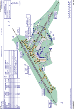
Name:Edinburgh Airport (RAF Turnhouse)
ICAO / IATA:EGPH / EDI

Details
Type:Airport (Aerodrome, Airfield)
Use:Public/Civil
Latitude:55°57'00"N (55.950000)
Longitude:3°22'21"W (-3.372499)
Elevation:136 ft (41 m)
Runways:2
Longest:8386 × 151 ft (2556 × 46 m)

Time
Timezone:UTC+0 (DST+3)
Local Time:

Weather
METAR:EGPH  041350Z 26011KT 9999 FEW030 07/01 Q1011
TAF:EGPH  041102Z 0412/0512 24016KT 9999 FEW025 BECMG 0415/0418 25006KT PROB40 0500/0510 5000 BR

Related Locations
Nearby:
Farthest:SZS: 11707 mi / 18841 km
Ryan's Creek, Stewart Island, STL, NZ

Find:

   beyond  
but within

Other Information
Maps:
Links:
Sources:


Airport Diagram

Airport diagram for EDI

Airport diagram PDF


Great Circle Mapper   Great Circle Mapper
Great Circle Mapper FAQ   Great Circle Mapper FAQ
  Karl's Home Page
KLSē   KLSē Home
   GC on Facebook
Airlines of the World   Airlines of the World
Donate via PayPal


Copyright © 2004-2023, Karl L. Swartz. All rights reserved.
All trademarks mentioned herein belong to their respective owners.

Please see credits for attribution and copyright information.

Karl Swartz <karl@kls2.com>
  Powered by FreeBSD
Valid HTML 4.01!
Labeled with ICRA
hCard Microformat
Geo Microformat