| Location |
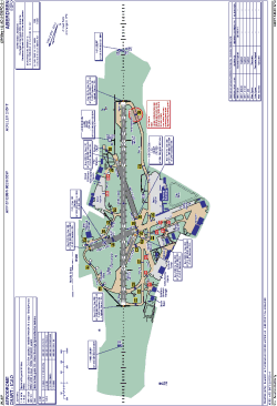
| City: | | Aberdeen, Aberdeenshire, Scotland, United Kingdom |
| Name: | Dyce |
| ICAO / IATA: | EGPD / ABZ |
Details |
| Type: | Airport (Aerodrome, Airfield) |
| Use: | Public/Civil |
| Latitude: | 57°12'09"N (57.202500) |
| Longitude: | 2°11'53"W (-2.198055) |
| Elevation: | 215 ft (66 m) |
| Runways: | 4 |
| Longest: | 6407 × 151 ft (1953 × 46 m) |
Time |
| Timezone: | UTC+0 (DST+3) |
| Local Time: | |
Weather |
| METAR: | EGPD | 041350Z 29013KT 9999 SCT022 05/01 Q1007
|
| TAF: | EGPD | 041102Z 0412/0512 30012KT 9999 FEW012 SCT020 PROB40 TEMPO 0412/0418 31015G25KT PROB30 TEMPO 0412/0414 7000 BKN012 BECMG 0421/0424 24005KT
|
Related Locations |
| Nearby: | |
| Farthest: | SZS: 11610 mi / 18684 km
Ryan's Creek, Stewart Island, STL, NZ |
Find: |
|
Other Information |
Maps:
|
Links:
|
Sources:
|
|