| Location |
| City: | | Elko, Nevada, United States |
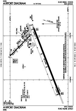
| Name: | Elko Regional |
| ICAO / IATA: | KEKO / EKO |
| FAA: | EKO |
Details |
| Type: | Airport (Part 139 Class I) |
| Use: | Public/Civil |
| Latitude: | 40°49'30"N (40.824999) |
| Longitude: | 115°47'29"W (-115.791336) |
| Datum: | WGS 1984 |
| Elevation: | 5139 ft (1566 m) |
| Runways: | 2 |
| Longest: | 7454 × 150 ft (2272 × 45.5 m) |
Time |
| Timezone: | UTC+26:08 (DST+29:08) |
| Local Time: | |
Weather |
| METAR: | KEKO | 041356Z AUTO 10003KT 10SM FEW045 01/M01 A2948 RMK AO2 UPE1257RAB07E10B14E21SNB1257E39 SLP984 P0004 T00111006
|
| TAF: | KEKO | 041139Z 0412/0512 21010KT P6SM VCSH SCT045 OVC060
FM041800 20015G25KT P6SM VCSH BKN030 OVC050
FM050100 22012KT 3SM -SHSN BR BKN015 OVC030
|
Related Locations |
| Nearby: | |
| Farthest: | FAME: 11066 mi / 17809 km
Marion Island, Prince Edward Islands, WC, ZA |
Find: |
|
Other Information |
Maps:
|
Delays:
|
Links:
|
Sources:
|
|