| Location |
| City: | | Derby, Leicestershire, England, United Kingdom |
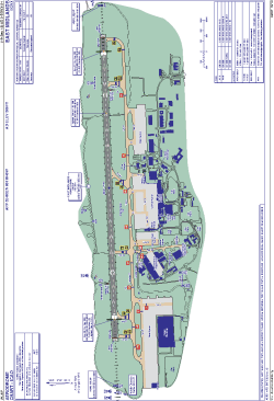
| Name: | East Midlands Airport (Castle Donnington) |
| ICAO / IATA: | EGNX / EMA |
Details |
| Type: | Airport (Aerodrome, Airfield) |
| Use: | Public/Civil |
| Latitude: | 52°49'52"N (52.831111) |
| Longitude: | 1°19'40"W (-1.327777) |
| Elevation: | 306 ft (93 m) |
| Runways: | 1 |
| Longest: | 9491 × 151 ft (2893 × 46 m) |
Time |
| Timezone: | UTC+0 (DST+3) |
| Local Time: | |
Weather |
| METAR: | EGNX | 041350Z 30014KT 9999 BKN025 08/04 Q1015
|
| TAF: | EGNX | 041100Z 0412/0512 21010KT 9999 SCT005 BKN016 BECMG 0412/0414 30010KT PROB40 0421/0502 7000 BECMG 0500/0503 VRB03KT PROB30 0502/0511 0300 FZFG BKN000 BECMG 0511/0512 17010KT
|
Related Locations |
| Nearby: | |
| Farthest: | NZDC: 11829 mi / 19036 km
Dunedin [City Heliport], OTA, NZ |
Find: |
|
Other Information |
Maps:
|
Sources:
|
|