| Location |
| City: | | Fresno, California, United States |
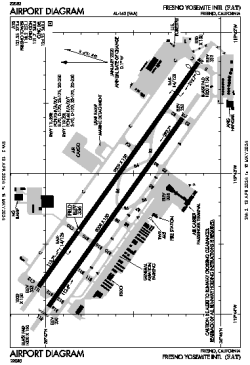
| Name: | Fresno Yosemite International Airport |
| ICAO / IATA: | KFAT / FAT |
| FAA: | FAT |
Details |
| Type: | Airport (Part 139 Class I) |
| Use: | Public/Civil |
| Latitude: | 36°46'36"N (36.776556) |
| Longitude: | 119°43'08"W (-119.718832) |
| Datum: | WGS 1984 |
| Elevation: | 335 ft (102 m) |
| Runways: | 2 |
| Longest: | 9539 × 150 ft (2907 × 45.5 m) |
Time |
| Timezone: | UTC+26:08 (DST+29:08) |
| Local Time: | |
Weather |
| METAR: | KFAT | 041353Z 17012KT 5SM RA BKN040 OVC046 11/08 A2967 RMK AO2 SLP047 P0004 T01110078
|
| TAF: | KFAT | 041146Z 0412/0512 13015KT P6SM VCSH BKN060 TEMPO 0414/0417 15017G22KT 3SM SHRA BR BKN035
FM041900 13015KT P6SM VCTS SCT035 BKN050CB
FM050200 28011G18KT P6SM VCSH BKN050
|
Related Locations |
| Nearby: | |
| Farthest: | ZSE: 11327 mi / 18229 km
St-Pierre (St-Pierre de la Réunion) [Pierrefonds], RE |
Find: |
|
Other Information |
Maps:
|
Delays:
|
Links:
|
Sources:
|
|