| Location |
| City: | | Dayton, Ohio, United States |
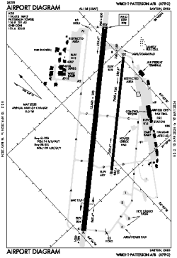
| Name: | Wright-Patterson AFB |
| ICAO / IATA: | KFFO / FFO |
| FAA: | FFO |
Details |
| Type: | Airport (Airfield) |
| Use: | Military |
| Latitude: | 39°49'33"N (39.825971) |
| Longitude: | 84°02'46"W (-84.046102) |
| Datum: | WGS 1984 |
| Elevation: | 823 ft (251 m) |
| Runways: | 2 |
| Longest: | 12600 × 300 ft (3840 × 91.5 m) |
Time |
| Timezone: | UTC+29:08 (DST+32:08) |
| Local Time: | |
Weather |
| METAR: | KFFO | 041356Z AUTO 17007KT 10SM CLR 07/05 A2993 RMK AO2 SLP143 T00700051
|
| TAF: | KFFO | 040302Z 0403/0509 18009KT 9999 FEW050 QNH2993INS BECMG 0409/0410 17009KT 8000 BR OVC010 QNH2984INS BECMG 0418/0419 18012G18KT 3200 -SHRA BR OVC007 QNH2979INS BECMG 0502/0503 18012KT 1600 BR OVC007 QNH2982INS TX10/0420Z TN05/0409Z
|
Related Locations |
| Nearby: | |
| Farthest: | YAUG: 11318 mi / 18214 km
Augusta [Augusta Airport], WA, AU |
Find: |
|
Other Information |
Maps:
|
Links:
|
Sources:
|
|