| Location |
| City: | | Fort Lauderdale, Florida, United States |
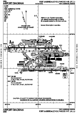
| Name: | Fort Lauderdale/Hollywood International Airport |
| ICAO / IATA: | KFLL / FLL |
| FAA: | FLL |
Details |
| Type: | Airport (Part 139 Class I) |
| Use: | Public/Civil |
| Latitude: | 26°04'18"N (26.071667) |
| Longitude: | 80°08'59"W (-80.149693) |
| Datum: | WGS 1984 |
| Elevation: | 65 ft (20 m) |
| Runways: | 2 |
| Longest: | 9000 × 150 ft (2743 × 45.5 m) |
Time |
| Timezone: | UTC+29:08 (DST+32:08) |
| Local Time: | |
Weather |
| METAR: | KFLL | 041411Z AUTO 33006KT 10SM BKN014 22/20 A3005 RMK AO2 T02170200
|
| TAF: | KFLL | 041402Z 0414/0518 34005KT P6SM SCT015 BKN035
FM041700 04010KT P6SM SCT020 BKN250
FM050000 VRB03KT P6SM FEW020 SCT250
|
Related Locations |
| Nearby: | |
| Farthest: | USL: 11605 mi / 18677 km
Useless Loop, WA, AU |
Find: |
|
Other Information |
Maps:
|
Delays:
|
Links:
|
Sources:
|
|