| Location |
| City: | | Fort Myers, Florida, United States |
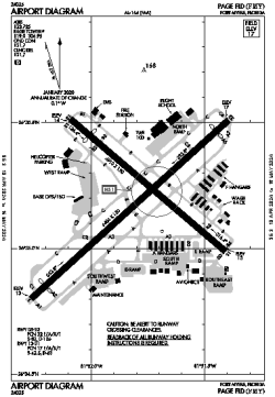
| Name: | Page Field |
| ICAO / IATA: | KFMY / FMY |
| FAA: | FMY |
Details |
| Type: | Airport (Airfield) |
| Use: | Public/Civil |
| Latitude: | 26°35'12"N (26.586615) |
| Longitude: | 81°51'48"W (-81.863246) |
| Datum: | WGS 1984 |
| Elevation: | 17 ft (5 m) |
| Runways: | 2 |
| Longest: | 6406 × 150 ft (1953 × 45.5 m) |
Time |
| Timezone: | UTC+29:08 (DST+32:08) |
| Local Time: | |
Weather |
| METAR: | KFMY | 041408Z 08004KT 9SM BKN008 OVC020 20/18 A3006 RMK AO2 T02000178
|
| TAF: | KFMY | 041122Z 0412/0512 VRB04KT 6SM BR SCT007 OVC025 TEMPO 0412/0414 1SM BR OVC005
FM041500 05005KT P6SM BKN020
FM041800 30004KT P6SM FEW030 BKN250
FM050200 VRB03KT P6SM FEW050 SCT200
|
Related Locations |
| Nearby: | |
| Farthest: | USL: 11500 mi / 18508 km
Useless Loop, WA, AU |
Find: |
|
Other Information |
Maps:
|
Delays:
|
Links:
|
Sources:
|
|