| Location |
| City: | | Flint, Michigan, United States |
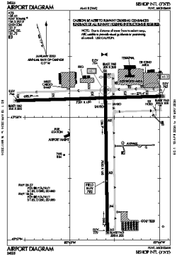
| Name: | Bishop International Airport |
| ICAO / IATA: | KFNT / FNT |
| FAA: | FNT |
Details |
| Type: | Airport (Part 139 Class I) |
| Use: | Public/Civil |
| Latitude: | 42°57'56"N (42.965464) |
| Longitude: | 83°44'41"W (-83.744737) |
| Datum: | WGS 1984 |
| Elevation: | 782 ft (238 m) |
| Runways: | 2 |
| Longest: | 7852 × 150 ft (2393 × 45.5 m) |
Time |
| Timezone: | UTC+29:08 (DST+32:08) |
| Local Time: | |
Weather |
| METAR: | KFNT | 041353Z 18009KT 10SM SCT048 BKN070 OVC100 09/06 A2982 RMK AO2 SLP101 T00890056
|
| TAF: | KFNT | 041120Z 0412/0512 18008KT P6SM SCT040 BKN070 TEMPO 0412/0414 5SM BR BKN040
FM041800 18014G22KT 5SM -SHRA BR BKN015 OVC040
FM042300 21012G18KT P6SM OVC015
FM050300 25010KT P6SM OVC025
FM050800 29008KT P6SM SCT025 BKN035
|
Related Locations |
| Nearby: | |
| Farthest: | YAUG: 11260 mi / 18121 km
Augusta [Augusta Airport], WA, AU |
Find: |
|
Other Information |
Maps:
|
Delays:
|
Links:
|
Sources:
|
|