| Location |
| City: | | Fort Dodge, Iowa, United States |
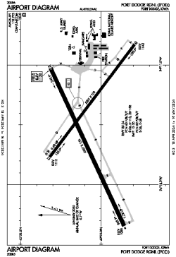
| Name: | Fort Dodge Regional |
| ICAO / IATA: | KFOD / FOD |
| FAA: | FOD |
Details |
| Type: | Airport (Part 139 Class I) |
| Use: | Public/Civil |
| Latitude: | 42°33'04"N (42.551194) |
| Longitude: | 94°11'31"W (-94.191832) |
| Datum: | WGS 1984 |
| Elevation: | 1156 ft (352 m) |
| Runways: | 2 |
| Longest: | 6547 × 150 ft (1996 × 45.5 m) |
Time |
| Timezone: | UTC+28:08 (DST+31:08) |
| Local Time: | |
Weather |
| METAR: | KFOD | 041417Z AUTO 33012G20KT 1 3/4SM -SN BR OVC013 M11/M12 A2986 RMK AO2 VIS 1 1/4V2 P0000 FZRANO
|
| TAF: | KFOD | 041136Z 0412/0512 32013G22KT P6SM OVC009
FM041330 32016G26KT P6SM BKN018 OVC030
FM041600 32015G24KT P6SM FEW040 SCT150
FM042300 34014KT P6SM SCT250
|
Related Locations |
| Nearby: | |
| Farthest: | YAUG: 10761 mi / 17318 km
Augusta [Augusta Airport], WA, AU |
Find: |
|
Other Information |
Maps:
|
Links:
|
Sources:
|
|