| Location |
| City: | | Greenville, Mississippi, United States |
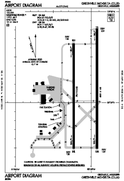
| Name: | Greenville Mid-Delta Airport |
| ICAO / IATA: | KGLH / GLH |
| FAA: | GLH |
Details |
| Type: | Airport (Airfield) |
| Use: | Public/Civil |
| Latitude: | 33°29'07"N (33.485248) |
| Longitude: | 90°59'04"W (-90.984485) |
| Datum: | WGS 1984 |
| Elevation: | 130 ft (40 m) |
| Runways: | 2 |
| Longest: | 8001 × 150 ft (2439 × 45.5 m) |
Time |
| Timezone: | UTC+28:08 (DST+31:08) |
| Local Time: | |
Weather |
| METAR: | KGLH | 041401Z 18011KT 10SM BKN011 BKN039 OVC060 16/14 A2994 RMK AO2 T01610139
|
| TAF: | KGLH | 041120Z 0412/0512 17008KT P6SM BKN010 OVC050
FM041300 18008KT 6SM BR BKN008 OVC050
FM041600 19012KT P6SM BKN015 OVC050
FM042000 20011KT P6SM BKN025 OVC250
FM050200 18006KT P6SM BKN010 BKN250
FM050700 16004KT 5SM BR BKN006 OVC030
|
Related Locations |
| Nearby: | |
| Farthest: | MQZ: 10945 mi / 17615 km
Margaret River [Margaret River Airport], WA, AU |
Find: |
|
Other Information |
Maps:
|
Delays:
|
Links:
|
Sources:
|
|