| Location |
| City: | | Jacksonville, Florida, United States |
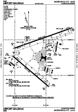
| Name: | Jacksonville International Airport |
| ICAO / IATA: | KJAX / JAX |
| FAA: | JAX |
Details |
| Type: | Airport (Part 139 Class I) |
| Use: | Public/Civil |
| Latitude: | 30°29'39"N (30.494046) |
| Longitude: | 81°41'16"W (-81.687846) |
| Datum: | WGS 1984 |
| Elevation: | 29 ft (9 m) |
| Runways: | 2 |
| Longest: | 10000 × 150 ft (3048 × 45.5 m) |
Time |
| Timezone: | UTC+29:08 (DST+32:08) |
| Local Time: | |
Weather |
| METAR: | KJAX | 041356Z 04004KT 10SM OVC010 14/12 A3009 RMK AO2 SLP191 T01440122
|
| TAF: | KJAX | 041121Z 0412/0512 VRB02KT P6SM SCT003 OVC009
FM041500 05004KT P6SM OVC012
FM041700 06005KT P6SM SCT015 BKN025
FM041900 08005KT P6SM BKN250
FM050000 VRB02KT P6SM SCT250
FM050800 00000KT 3SM BR FEW250
|
Related Locations |
| Nearby: | |
| Farthest: | USL: 11479 mi / 18474 km
Useless Loop, WA, AU |
Find: |
|
Other Information |
Maps:
|
Delays:
|
Links:
|
Sources:
|
|