| Location |
| City: | | Allentown, Pennsylvania, United States |
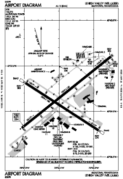
| Name: | Lehigh Valley International Airport |
| ICAO / IATA: | KABE / ABE |
| FAA: | ABE |
Details |
| Type: | Airport (Part 139 Class I) |
| Use: | Public/Civil |
| Latitude: | 40°39'09"N (40.652363) |
| Longitude: | 75°26'25"W (-75.440405) |
| Datum: | WGS 1984 |
| Elevation: | 393 ft (120 m) |
| Runways: | 2 |
| Longest: | 7599 × 150 ft (2316 × 45.5 m) |
Time |
| Timezone: | UTC+29:08 (DST+32:08) |
| Local Time: | |
Weather |
| METAR: | KABE | 041351Z 00000KT 4SM HZ CLR 01/M02 A3010 RMK AO2 SLP197 T00111017
|
| TAF: | KABE | 041120Z 0412/0512 VRB03KT 4SM BR SCT250
FM041400 VRB03KT P6SM SCT250
FM050300 VRB03KT 6SM BR BKN200
FM050700 VRB03KT 5SM BR OVC050
|
Related Locations |
| Nearby: | |
| Farthest: | YAUG: 11712 mi / 18848 km
Augusta [Augusta Airport], WA, AU |
Find: |
|
Other Information |
Maps:
|
Delays:
|
Links:
|
Sources:
|
|