| Location |
| City: | | Seattle, Washington, United States |
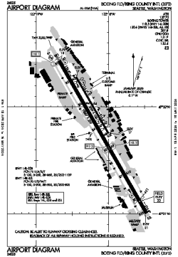
| Name: | Boeing Field/King County International Airport |
| ICAO / IATA: | KBFI / BFI |
| FAA: | BFI |
Details |
| Type: | Airport (Part 139 Class IV) |
| Use: | Public/Civil |
| Latitude: | 47°31'48"N (47.529972) |
| Longitude: | 122°18'07"W (-122.301943) |
| Datum: | WGS 1984 |
| Elevation: | 21 ft (6 m) |
| Runways: | 2 |
| Longest: | 10007 × 200 ft (3050 × 61 m) |
Time |
| Timezone: | UTC+26:08 (DST+29:08) |
| Local Time: | |
Weather |
| METAR: | KBFI | 041400Z 36008G17KT 320V040 2SM -SN OVC014 M03/M06 A2957 RMK AO2 P0000 T10281056
|
| TAF: | KBFI | 041131Z 0412/0512 36007KT 2SM -SN BR SCT005 OVC013 TEMPO 0412/0416 3/4SM -SN BR OVC008
FM041600 36007KT 5SM -SN BR OVC015
FM041900 36007KT P6SM BKN020 OVC030
FM042300 36007KT P6SM BKN050
FM050500 06004KT P6SM BKN050
|
Related Locations |
| Nearby: | |
| Farthest: | FAME: 11507 mi / 18518 km
Marion Island, Prince Edward Islands, WC, ZA |
Find: |
|
Other Information |
Maps:
|
Delays:
|
Links:
|
Sources:
|
|