| Location |
| City: | | Belleville, Illinois, United States |
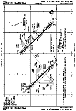
| Name: | Scott AFB/Midamerica St. Louis Airport |
| ICAO / IATA: | KBLV / BLV |
| FAA: | BLV |
Details |
| Type: | Airport (Part 139 Class I) |
| Use: | Public/Civil, Military |
| Latitude: | 38°32'43"N (38.545173) |
| Longitude: | 89°50'07"W (-89.835185) |
| Datum: | WGS 1984 |
| Elevation: | 459 ft (140 m) |
| Runways: | 2 |
| Longest: | 10000 × 150 ft (3048 × 45.5 m) |
Time |
| Timezone: | UTC+28:08 (DST+31:08) |
| Local Time: | |
Weather |
| METAR: | KBLV | 041356Z AUTO 15007KT 10SM OVC013 13/11 A2977 RMK AO2 CIG 012 RWY14L CIG 012 RWY32L CIG 012 RWY32R SLP084 T01250111 $
|
| TAF: | KBLV | 041045Z 0410/0514 18012KT 9999 BKN015 OVC020 520043 QNH2972INS BECMG 0423/0424 34009KT 9999 BKN010 OVC020 QNH2984INS BECMG 0503/0504 01009KT 9999 SCT010 BKN020 QNH2992INS BECMG 0508/0509 04006KT 9999 BKN035 QNH3000INS TX18/0421Z TN01/0510Z
|
Related Locations |
| Nearby: | |
| Farthest: | YAUG: 11025 mi / 17743 km
Augusta [Augusta Airport], WA, AU |
Find: |
|
Other Information |
Maps:
|
Links:
|
Sources:
|
|