| Location |
| City: | | Beaumont/Port Arthur, Texas, United States |
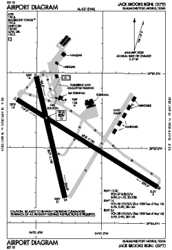
| Name: | Jack Brooks Regional |
| ICAO / IATA: | KBPT / BPT |
| FAA: | BPT |
Details |
| Type: | Airport (Part 139 Class I) |
| Use: | Public/Civil |
| Latitude: | 29°57'03"N (29.950831) |
| Longitude: | 94°01'15"W (-94.020698) |
| Datum: | WGS 1984 |
| Elevation: | 14 ft (4 m) |
| Runways: | 2 |
| Longest: | 6751 × 150 ft (2058 × 45.5 m) |
Time |
| Timezone: | UTC+28:08 (DST+31:08) |
| Local Time: | |
Weather |
| METAR: | KBPT | 041353Z 20003KT M1/4SM R12/1000V1200FT FG VV002 19/18 A2994 RMK AO2 RAB06E20 SLP139 P0001 T01940183
|
| TAF: | KBPT | 041340Z 0414/0512 18004KT 1/4SM FG VCSH VV002 TEMPO 0414/0416 3SM BR OVC005
FM041600 17005KT 4SM BR VCSH OVC007
FM041700 18006KT P6SM VCSH OVC012
FM042100 21008KT P6SM VCSH OVC020
FM050200 16004KT 4SM BR OVC005 TEMPO 0508/0512 1/2SM FG VV002
|
Related Locations |
| Nearby: | |
| Farthest: | CCK: 11027 mi / 17747 km
West Island (Pulau Panjang) [Cocos (Keeling) Islands], CC |
Find: |
|
Other Information |
Maps:
|
Delays:
|
Links:
|
Sources:
|
|