| Location |
| City: | | Clarksburg, West Virginia, United States |
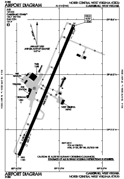
| Name: | North Central West Virginia Airport |
| ICAO / IATA: | KCKB / CKB |
| FAA: | CKB |
Details |
| Type: | Airport (Part 139 Class I) |
| Use: | Public/Civil |
| Latitude: | 39°17'52"N (39.297655) |
| Longitude: | 80°13'39"W (-80.227531) |
| Datum: | WGS 1984 |
| Elevation: | 1223 ft (373 m) |
| Runways: | 1 |
| Longest: | 7800 × 150 ft (2377 × 45.5 m) |
Time |
| Timezone: | UTC+29:08 (DST+32:08) |
| Local Time: | |
Weather |
| METAR: | KCKB | 041353Z 00000KT 7SM CLR 02/00 A3006 RMK AO2 SLP182 T00220000 $
|
| TAF: | KCKB | 041159Z 0412/0512 00000KT 3SM BR SKC TEMPO 0412/0413 1/2SM FZFG
FM041400 VRB03KT 6SM BR SKC
FM041700 19006KT P6SM FEW250
FM050200 20005KT P6SM BKN060
FM050500 20007KT 6SM -SHRA BKN020
FM050800 22006KT 5SM -SHRA BR OVC007
|
Related Locations |
| Nearby: | |
| Farthest: | YAUG: 11524 mi / 18545 km
Augusta [Augusta Airport], WA, AU |
Find: |
|
Other Information |
Maps:
|
Delays:
|
Links:
|
Sources:
|
|