| Location |
| City: | | Houston, Texas, United States |
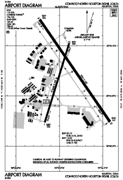
| Name: | Conroe/North Houston Regional |
| ICAO / IATA: | KCXO / CXO |
| FAA: | CXO |
Details |
| Type: | Airport (Airfield) |
| Use: | Public/Civil |
| Latitude: | 30°21'12"N (30.353396) |
| Longitude: | 95°24'54"W (-95.415081) |
| Datum: | WGS 1984 |
| Elevation: | 244 ft (74 m) |
| Runways: | 2 |
| Longest: | 7501 × 150 ft (2286 × 45.5 m) |
Time |
| Timezone: | UTC+28:08 (DST+31:08) |
| Local Time: | |
Weather |
| METAR: | KCXO | 041419Z 17004KT 1SM BR OVC003 19/19 A2994 RMK AO2 T01890189
|
| TAF: | KCXO | 041215Z 0412/0512 19003KT 1/4SM FG OVC002
FM041300 19003KT 1/2SM FG OVC004
FM041500 20006KT 4SM BR OVC006
FM041700 21008KT P6SM BKN007 OVC015
FM041900 21008KT P6SM BKN025
FM042100 21006KT P6SM SCT025 BKN150
FM050300 18004KT P6SM SCT008 BKN025
FM050700 00000KT 4SM BR OVC007
FM051000 00000KT 1/2SM FG OVC003
|
Related Locations |
| Nearby: | |
| Farthest: | CCK: 10959 mi / 17637 km
West Island (Pulau Panjang) [Cocos (Keeling) Islands], CC |
Find: |
|
Other Information |
Maps:
|
Links:
|
Sources:
|
|