| Location |
| City: | | Erie, Pennsylvania, United States |
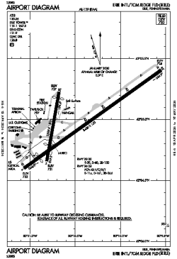
| Name: | Erie International/Tom Ridge Field |
| ICAO / IATA: | KERI / ERI |
| FAA: | ERI |
Details |
| Type: | Airport (Part 139 Class I) |
| Use: | Public/Civil |
| Latitude: | 42°04'59"N (42.083083) |
| Longitude: | 80°10'26"W (-80.173943) |
| Datum: | WGS 1984 |
| Elevation: | 732 ft (223 m) |
| Runways: | 2 |
| Longest: | 8420 × 150 ft (2566 × 45.5 m) |
Time |
| Timezone: | UTC+29:08 (DST+32:08) |
| Local Time: | |
Weather |
| METAR: | KERI | 041351Z 18009KT 10SM CLR 11/04 A2996 RMK AO2 SLP147 T01110039
|
| TAF: | KERI | 041124Z 0412/0512 19010KT P6SM OVC060
FM042300 18015G25KT 6SM -SHRA OVC050
FM050000 18015G25KT 6SM -SHRA OVC030
FM050100 19015G25KT 5SM -SHRA BR OVC015
FM050600 23014KT P6SM OVC008
|
Related Locations |
| Nearby: | |
| Farthest: | YAUG: 11450 mi / 18427 km
Augusta [Augusta Airport], WA, AU |
Find: |
|
Other Information |
Maps:
|
Delays:
|
Links:
|
Sources:
|
|