| Location |
| City: | | Eugene, Oregon, United States |
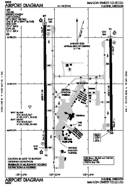
| Name: | Mahlon Sweet Field |
| ICAO / IATA: | KEUG / EUG |
| FAA: | EUG |
Details |
| Type: | Airport (Part 139 Class I) |
| Use: | Public/Civil |
| Latitude: | 44°07'28"N (44.124583) |
| Longitude: | 123°12'43"W (-123.211971) |
| Datum: | WGS 1984 |
| Elevation: | 373 ft (114 m) |
| Runways: | 2 |
| Longest: | 8009 × 150 ft (2441 × 45.5 m) |
Time |
| Timezone: | UTC+26:08 (DST+29:08) |
| Local Time: | |
Weather |
| METAR: | KEUG | 041354Z 21003KT 7SM -RASN FEW006 OVC035 02/00 A2944 RMK AO2 SLP971 P0001 T00170000 $
|
| TAF: | KEUG | 041139Z 0412/0512 17005KT P6SM -SHRA FEW020 BKN040 OVC060
FM041400 15004KT P6SM -SHRASN FEW008 BKN020 OVC035 TEMPO 0414/0418 2SM -SHSN BKN006 OVC020
FM041800 VRB03KT P6SM -SHSN SCT015 BKN025 OVC040
FM050200 01006KT P6SM VCSH BKN025 OVC045
|
Related Locations |
| Nearby: | |
| Farthest: | FAME: 11503 mi / 18513 km
Marion Island, Prince Edward Islands, WC, ZA |
Find: |
|
Other Information |
Maps:
|
Delays:
|
Links:
|
Sources:
|
|