| Location |
| City: | | Glens Falls, New York, United States |
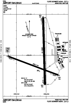
| Name: | Floyd Bennett Memorial Airport |
| ICAO / IATA: | KGFL / GFL |
| FAA: | GFL |
Details |
| Type: | Airport (Part 139 Class IV) |
| Use: | Public/Civil |
| Latitude: | 43°20'28"N (43.341222) |
| Longitude: | 73°36'37"W (-73.610305) |
| Datum: | WGS 1984 |
| Elevation: | 328 ft (100 m) |
| Runways: | 2 |
| Longest: | 5000 × 150 ft (1524 × 45.5 m) |
Time |
| Timezone: | UTC+29:08 (DST+32:08) |
| Local Time: | |
Weather |
| METAR: | KGFL | 041353Z AUTO 22009KT 8SM BKN034 OVC065 04/00 A3003 RMK AO2 SLP177 T00440000
|
| TAF: | KGFL | 041123Z 0412/0512 20005KT P6SM BKN035
FM050200 19004KT 4SM BR VCSH BKN250
FM050700 19005KT 3SM -SHRA BR OVC035
FM051000 19005KT 2SM BR OVC015
|
Related Locations |
| Nearby: | |
| Farthest: | YAUG: 11654 mi / 18756 km
Augusta [Augusta Airport], WA, AU |
Find: |
|
Other Information |
Maps:
|
Links:
|
Sources:
|
|