| Location |
| City: | | Gainesville, Florida, United States |
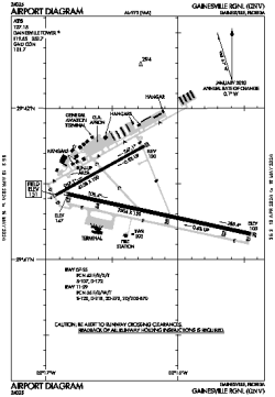
| Name: | Gainesville Regional |
| ICAO / IATA: | KGNV / GNV |
| FAA: | GNV |
Details |
| Type: | Airport (Part 139 Class I) |
| Use: | Public/Civil |
| Latitude: | 29°41'24"N (29.690056) |
| Longitude: | 82°16'18"W (-82.271777) |
| Datum: | WGS 1984 |
| Elevation: | 151 ft (46 m) |
| Runways: | 2 |
| Longest: | 7504 × 150 ft (2287 × 45.5 m) |
Time |
| Timezone: | UTC+29:08 (DST+32:08) |
| Local Time: | |
Weather |
| METAR: | KGNV | 041353Z 00000KT 10SM OVC014 16/12 A3013 RMK AO2 SLP200 T01610122
|
| TAF: | KGNV | 041121Z 0412/0512 VRB03KT P6SM SCT007 OVC012
FM041700 04004KT P6SM SCT015 BKN025
FM041800 04003KT P6SM BKN250
FM050000 VRB02KT P6SM SCT250
FM050800 00000KT 5SM BR FEW250
FM051000 00000KT 1SM BR SCT003 SCT250
|
Related Locations |
| Nearby: | |
| Farthest: | USL: 11457 mi / 18439 km
Useless Loop, WA, AU |
Find: |
|
Other Information |
Maps:
|
Delays:
|
Links:
|
Sources:
|
|