| Location |
| City: | | Wichita, Kansas, United States |
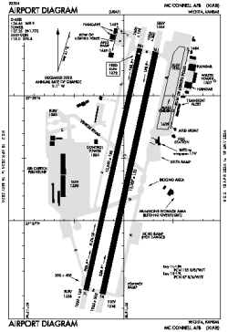
| Name: | McConnell AFB |
| ICAO / IATA: | KIAB / IAB |
| FAA: | IAB |
Details |
| Type: | Airport (Airfield) |
| Use: | Military |
| Latitude: | 37°37'23"N (37.623116) |
| Longitude: | 97°16'03"W (-97.267628) |
| Datum: | WGS 1984 |
| Elevation: | 1371 ft (418 m) |
| Runways: | 2 |
| Longest: | 12007 × 150 ft (3660 × 45.5 m) |
Time |
| Timezone: | UTC+28:08 (DST+31:08) |
| Local Time: | |
Weather |
| METAR: | KIAB | 041356Z AUTO 35015G22KT 7SM BR OVC004 00/00 A2983 RMK AO2 PK WND 35029/1256 PRESRR SLP107 T00020001
|
| TAF: | KIAB | 041000Z 0410/0516 29009KT 9999 SKC QNH2957INS BECMG 0410/0411 35025G35KT 3200 BR BKN002 OVC009 510003 QNH2970INS TEMPO 0411/0413 0800 FG BECMG 0413/0414 36015G25KT 9999 NSW SCT010 QNH2985INS BECMG 0415/0416 01010G20KT 9999 FEW030 QNH2986INS BECMG 0420/0421 02009KT 9999 SKC QNH2988INS TX12/0410Z TN00/0510Z
|
Related Locations |
| Nearby: | |
| Farthest: | RRG: 10742 mi / 17288 km
Plaine Corail [Sir Gaëtan Duval Airport (Plaine Corail Airport)], Rodrigues Island, MU |
Find: |
|
Other Information |
Maps:
|
Links:
|
Sources:
|
|