| Location |
| City: | | Winston-Salem, North Carolina, United States |
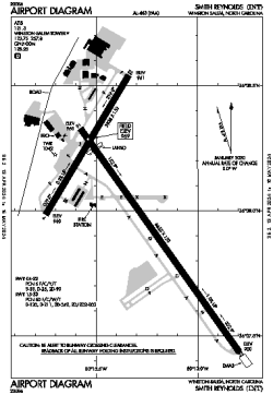
| Name: | Smith Reynolds Airport |
| ICAO / IATA: | KINT / INT |
| FAA: | INT |
Details |
| Type: | Airport (Part 139 Class IV) |
| Use: | Public/Civil |
| Latitude: | 36°08'01"N (36.133714) |
| Longitude: | 80°13'19"W (-80.221987) |
| Datum: | WGS 1984 |
| Elevation: | 969 ft (295 m) |
| Runways: | 2 |
| Longest: | 6655 × 150 ft (2028 × 45.5 m) |
Time |
| Timezone: | UTC+29:08 (DST+32:08) |
| Local Time: | |
Weather |
| METAR: | KINT | 041354Z 00000KT 10SM CLR 10/04 A3009 RMK AO2 SLP187 T01000044
|
| TAF: | KINT | 041128Z 0412/0512 00000KT P6SM SKC
FM050000 VRB03KT P6SM BKN180
FM050500 VRB03KT P6SM BKN100
FM050800 VRB03KT P6SM OVC060
|
Related Locations |
| Nearby: | |
| Farthest: | YAUG: 11566 mi / 18613 km
Augusta [Augusta Airport], WA, AU |
Find: |
|
Other Information |
Maps:
|
Links:
|
Sources:
|
|