| Location |
| City: | | Jackson, Mississippi, United States |
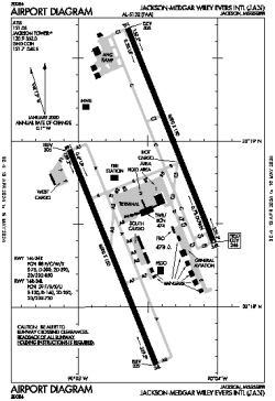
| Name: | Jackson-Evers International Airport |
| ICAO / IATA: | KJAN / JAN |
| FAA: | JAN |
Details |
| Type: | Airport (Part 139 Class I) |
| Use: | Public/Civil |
| Latitude: | 32°18'40"N (32.311167) |
| Longitude: | 90°04'33"W (-90.075888) |
| Datum: | WGS 1984 |
| Elevation: | 346 ft (105 m) |
| Runways: | 2 |
| Longest: | 8500 × 150 ft (2591 × 45.5 m) |
Time |
| Timezone: | UTC+28:08 (DST+31:08) |
| Local Time: | |
Weather |
| METAR: | KJAN | 041354Z 16006KT 4SM BR OVC002 15/14 A3000 RMK AO2 SLP158 T01500139 $
|
| TAF: | KJAN | 041120Z 0412/0512 16007KT 6SM BR VCSH BKN006 OVC040
FM041600 17009KT P6SM BKN015 OVC025
FM041900 18008KT P6SM BKN025 BKN050
FM050200 18005KT 6SM BR BKN008 BKN050
FM050800 18004KT 3SM BR BKN004 BKN050
|
Related Locations |
| Nearby: | |
| Farthest: | MQZ: 10984 mi / 17677 km
Margaret River [Margaret River Airport], WA, AU |
Find: |
|
Other Information |
Maps:
|
Delays:
|
Links:
|
Sources:
|
|