| Location |
| City: | | New York, New York, United States |
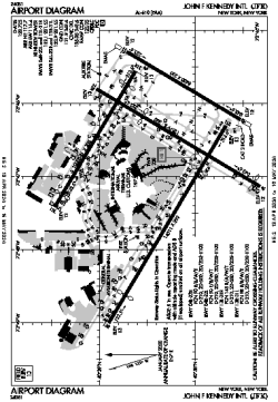
| Name: | John F Kennedy International Airport |
| ICAO / IATA: | KJFK / JFK |
| FAA: | JFK |
Details |
| Type: | Airport (Part 139 Class I) |
| Use: | Public/Civil |
| Latitude: | 40°38'24"N (40.639928) |
| Longitude: | 73°46'43"W (-73.778691) |
| Datum: | WGS 1984 |
| Elevation: | 13 ft (4 m) |
| Runways: | 4 |
| Longest: | 14511 × 200 ft (4423 × 61 m) |
Time |
| Timezone: | UTC+29:08 (DST+32:08) |
| Local Time: | |
Weather |
| METAR: | KJFK | 041351Z 19005KT 7SM FEW250 04/03 A3012 RMK AO2 SLP198 T00390033
|
| TAF: | KJFK | 041337Z 0414/0518 22003KT P6SM FEW250
FM041500 20005KT P6SM FEW250
FM042300 VRB04KT 6SM BR FEW020 SCT250
FM050200 20002KT 5SM BR SCT020 SCT200
FM050900 00000KT 3SM BR BKN020
FM051300 21005KT 6SM BR SCT020 BKN050
FM051500 23005KT P6SM SCT050 SCT250
|
Related Locations |
| Nearby: | |
| Farthest: | YAUG: 11782 mi / 18961 km
Augusta [Augusta Airport], WA, AU |
Find: |
|
Other Information |
Maps:
|
Delays:
|
Links:
|
Sources:
|
|