| Location |
| City: | | Johnstown, Pennsylvania, United States |
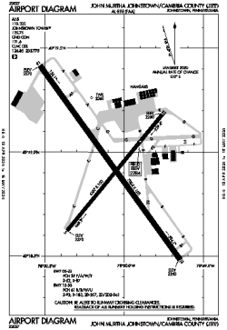
| Name: | John Murtha Johnstown/Cambria County Airport |
| ICAO / IATA: | KJST / JST |
| FAA: | JST |
Details |
| Type: | Airport (Part 139 Class I) |
| Use: | Public/Civil |
| Latitude: | 40°18'56"N (40.315556) |
| Longitude: | 78°50'05"W (-78.834666) |
| Datum: | WGS 1984 |
| Elevation: | 2284 ft (696 m) |
| Runways: | 2 |
| Longest: | 7004 × 150 ft (2135 × 45.5 m) |
Time |
| Timezone: | UTC+29:08 (DST+32:08) |
| Local Time: | |
Weather |
| METAR: | KJST | 041354Z AUTO 20006KT 10SM CLR 07/02 A3005 RMK AO2 SLP185 T00720022
|
| TAF: | KJST | 041150Z 0412/0512 21005KT P6SM SKC
FM050000 18008KT P6SM OVC040
FM050300 19012KT 3SM -RA BR OVC012
|
Related Locations |
| Nearby: | |
| Farthest: | YAUG: 11567 mi / 18616 km
Augusta [Augusta Airport], WA, AU |
Find: |
|
Other Information |
Maps:
|
Links:
|
Sources:
|
|