| Location |
| City: | | Saginaw, Michigan, United States |
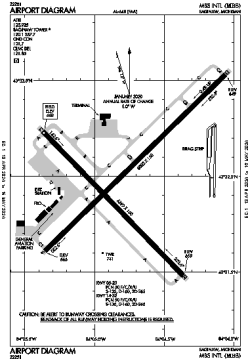
| Name: | MBS International Airport |
| ICAO / IATA: | KMBS / MBS |
| FAA: | MBS |
Details |
| Type: | Airport (Part 139 Class I) |
| Use: | Public/Civil |
| Latitude: | 43°31'59"N (43.532927) |
| Longitude: | 84°04'47"W (-84.079635) |
| Datum: | WGS 1984 |
| Elevation: | 668 ft (204 m) |
| Runways: | 2 |
| Longest: | 8002 × 150 ft (2439 × 45.5 m) |
Time |
| Timezone: | UTC+29:08 (DST+32:08) |
| Local Time: | |
Weather |
| METAR: | KMBS | 041353Z 17009KT 9SM FEW070 SCT100 08/06 A2977 RMK AO2 SLP083 T00780061
|
| TAF: | KMBS | 041323Z 0413/0512 18010KT 6SM BR SCT030 BKN080 OVC200 TEMPO 0414/0417 4SM BR OVC030
FM041700 20010KT 2SM -SHRA BR BKN008 OVC030
FM042200 26012KT P6SM OVC015
FM050200 25010KT P6SM OVC025
FM050700 29008KT P6SM SCT025 BKN035
|
Related Locations |
| Nearby: | |
| Farthest: | YAUG: 11228 mi / 18070 km
Augusta [Augusta Airport], WA, AU |
Find: |
|
Other Information |
Maps:
|
Delays:
|
Links:
|
Sources:
|
|