| Location |
| City: | | Oakland, California, United States |
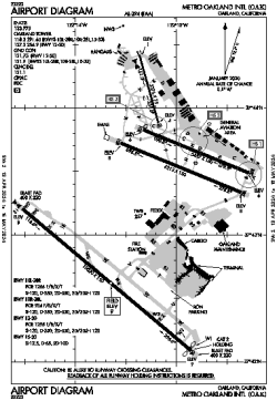
| Name: | Metro Oakland International Airport |
| ICAO / IATA: | KOAK / OAK |
| FAA: | OAK |
Details |
| Type: | Airport (Part 139 Class I) |
| Use: | Public/Civil |
| Latitude: | 37°43'17"N (37.721261) |
| Longitude: | 122°13'16"W (-122.221150) |
| Datum: | WGS 1984 |
| Elevation: | 9 ft (3 m) |
| Runways: | 4 |
| Longest: | 10520 × 150 ft (3206 × 45.5 m) |
Time |
| Timezone: | UTC+26:08 (DST+29:08) |
| Local Time: | |
Weather |
| METAR: | KOAK | 041353Z 28021KT 7SM -RA FEW013 BKN029 OVC037 10/08 A2955 RMK AO2 PK WND 26030/1337 RAE1256B32 SLP005 P0000 T01000078
|
| TAF: | KOAK | 041138Z 0412/0518 18017G22KT P6SM -SHRA FEW010 BKN013 OVC030
FM041600 23016G23KT P6SM -SHRA SCT020 BKN040
FM042200 24021G28KT P6SM -SHRA OVC030
FM050300 25016G23KT P6SM -RA OVC025
FM050800 25015KT P6SM -SHRA OVC025
FM051500 28006KT P6SM VCSH SCT050 BKN150
|
Related Locations |
| Nearby: | |
| Farthest: | FTU: 11354 mi / 18272 km
Tolagnaro [Maurillac Airport (Fort Dauphin Airport)], MG |
Find: |
|
Other Information |
Maps:
|
Delays:
|
Links:
|
Sources:
|
|