| Location |
| City: | | Wolf Point, Montana, United States |
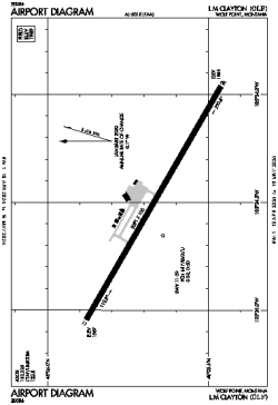
| Name: | L M Clayton Airport |
| ICAO / IATA: | KOLF / OLF |
| FAA: | OLF |
Details |
| Type: | Airport (Airfield) |
| Use: | Public/Civil |
| Latitude: | 48°05'40"N (48.094500) |
| Longitude: | 105°34'30"W (-105.575055) |
| Datum: | WGS 1984 |
| Elevation: | 1988 ft (606 m) |
| Runways: | 1 |
| Longest: | 5091 × 100 ft (1552 × 30.5 m) |
Time |
| Timezone: | UTC+27:08 (DST+30:08) |
| Local Time: | |
Weather |
| METAR: | KOLF | 041353Z AUTO 03005KT 10SM FEW033 BKN090 M23/M27 A3019 RMK AO2 SLP286 T12281272 $
|
| TAF: | KOLF | 041120Z 0412/0512 36008KT P6SM SCT025 OVC050 TEMPO 0412/0413 4SM -SN OVC025
FM042300 08009KT P6SM OVC021
FM050000 08009KT 1SM -SN OVC017
FM050400 06009KT 4SM -SN OVC020
FM050800 07008KT P6SM BKN020
|
Related Locations |
| Nearby: | |
| Farthest: | FAME: 10741 mi / 17285 km
Marion Island, Prince Edward Islands, WC, ZA |
Find: |
|
Other Information |
Maps:
|
Links:
|
Sources:
|
|