| Location |
| City: | | Fort Novosel, Alabama, United States |
| Near (Alt.): | Ozark |
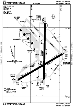
| Name: | Cairns AAF Airport (Fort Novosel) |
| ICAO / IATA: | KOZR / OZR |
| FAA: | OZR |
Details |
| Type: | Airport (Airfield) |
| Use: | Military |
| Latitude: | 31°16'33"N (31.275775) |
| Longitude: | 85°42'48"W (-85.713349) |
| Datum: | WGS 1984 |
| Elevation: | 301 ft (92 m) |
| Runways: | 2 |
| Longest: | 5025 × 150 ft (1532 × 45.5 m) |
Time |
| Timezone: | UTC+28:08 (DST+31:08) |
| Local Time: | |
Weather |
| METAR: | KOZR | 041406Z AUTO 05004KT 3SM BR OVC002 12/12 A3008 RMK AO2 OVC V BKN SLP188
|
| TAF: | KOZR | 040800Z 0408/0514 VRB04KT 1600 BR BKN001 QNH3002INS TEMPO 0408/0416 0400 FG OVC001 BECMG 0415/0416 17004KT 9999 NSW BKN009 QNH3002INS BECMG 0420/0421 18006KT 9999 BKN012 QNH3002INS BECMG 0505/0506 18006KT 9999 OVC007 QNH3006INS BECMG 0508/0509 18004KT 4800 BR OVC004 QNH3008INS TX21/0420Z TN10/0412Z
|
Related Locations |
| Nearby: | |
| Farthest: | USL: 11234 mi / 18079 km
Useless Loop, WA, AU |
Find: |
|
Other Information |
Maps:
|
Links:
|
Sources:
|
|