| Location |
| City: | | Sacramento, California, United States |
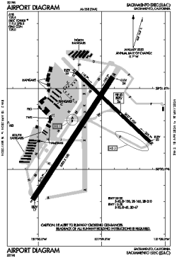
| Name: | Sacramento Exec Airport |
| ICAO / IATA: | KSAC / SAC |
| FAA: | SAC |
Details |
| Type: | Airport (Airfield) |
| Use: | Public/Civil |
| Latitude: | 38°30'46"N (38.512861) |
| Longitude: | 121°29'36"W (-121.493299) |
| Datum: | WGS 1984 |
| Elevation: | 23 ft (7 m) |
| Runways: | 2 |
| Longest: | 5503 × 150 ft (1677 × 45.5 m) |
Time |
| Timezone: | UTC+26:08 (DST+29:08) |
| Local Time: | |
Weather |
| METAR: | KSAC | 041413Z 16010G22KT 10SM BKN028 09/08 A2950 RMK AO2 RAE1359 P0000 T00890078
|
| TAF: | KSAC | 041132Z 0412/0512 16015G23KT P6SM -SHRA OVC040 TEMPO 0412/0416 3SM SHRA BKN020
FM041700 21014G22KT P6SM -SHRA OVC050
FM050200 19008KT P6SM -SHRA OVC050
|
Related Locations |
| Nearby: | |
| Farthest: | FTU: 11286 mi / 18164 km
Tolagnaro [Maurillac Airport (Fort Dauphin Airport)], MG |
Find: |
|
Other Information |
Maps:
|
Delays:
|
Links:
|
Sources:
|
|