| Location |
| City: | | Oklahoma City, Oklahoma, United States |
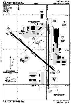
| Name: | Tinker AFB |
| ICAO / IATA: | KTIK / TIK |
| FAA: | TIK |
Details |
| Type: | Airport (Airfield) |
| Use: | Military |
| Latitude: | 35°24'53"N (35.414750) |
| Longitude: | 97°23'12"W (-97.386638) |
| Datum: | WGS 1984 |
| Elevation: | 1290 ft (393 m) |
| Runways: | 2 |
| Longest: | 11100 × 200 ft (3383 × 61 m) |
Time |
| Timezone: | UTC+28:08 (DST+31:08) |
| Local Time: | |
Weather |
| METAR: | KTIK | 041356Z AUTO 33008KT 10SM CLR 10/06 A2978 RMK AO2 SLP088 T00960056 $
|
| TAF: | KTIK | 041000Z 0410/0516 23009KT 9999 SKC 510022 QNH2966INS BECMG 0417/0418 36009KT 9999 SCT011 QNH2987INS TEMPO 0417/0500 BKN011 BECMG 0500/0501 VRB06KT 9999 BKN011 QNH2985INS BECMG 0509/0510 12006KT 8000 BR BKN004 QNH2982INS BECMG 0514/0515 15006KT 8000 BR SCT004 QNH2983INS TX15/0418Z TN10/0506Z
|
Related Locations |
| Nearby: | |
| Farthest: | RRG: 10845 mi / 17454 km
Plaine Corail [Sir Gaëtan Duval Airport (Plaine Corail Airport)], Rodrigues Island, MU |
Find: |
|
Other Information |
Maps:
|
Links:
|
Sources:
|
|